Waterfalls and wild swimming in the Scenic Rim, Australia
Want to know a secret? Hidden at the base of Mt Barney in southern Queensland’s Scenic Rim Region lies waterfalls, swimming holes and a beautiful gorge carved into rock.
Outdoor enthusiasts are spoilt for choice in the Scenic Rim, which is located only a couple of hours drive from Brisbane and the Gold Coast. The region is surrounded by mountains and lush rainforest due to the area once being home to active volcanoes.
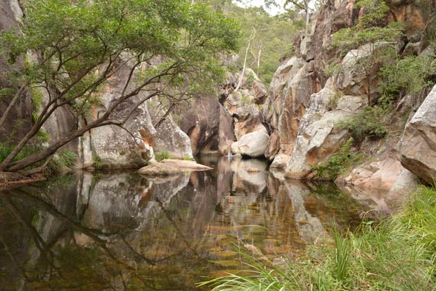
The picturesque Lower Portals gorge and swimming hole is located in the Mt Barney National Park. To get there, take the 7.5km return Lower Portals trail.
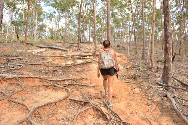
Within minutes of leaving the carpark, you’ll be negotiating boulders on the trail and passing through tall gum forests and bright green grass trees.
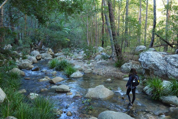
The dirt track winds through tree-filled vistas and then you’ll be rock hopping across Mt Barney Creek, before heading up the red sandstone track.
If you’re lucky, you might spot some rock wallabies near the track.
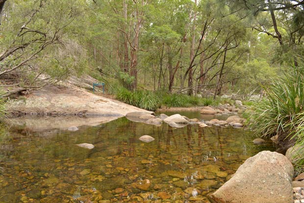
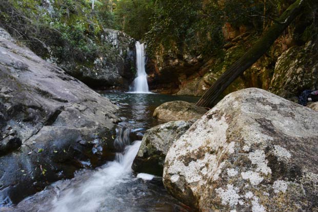
When you arrive at the massive boulders sitting in the creek, you’ll need to manoeuvre up through a couple of round boulders on the right to reach the gorge section. The waterhole is an impressive sight surrounded by giant boulders and the hint of Mt Barney over the top of the trees and is the perfect place to cool off with a swim or to get your feet wet.
Camping is possible in the area. Head to the Queensland National Parks website for details.
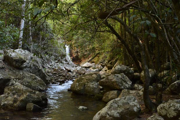
The Cronan Creek Secret Falls is even more special – because the Cronan Creek Track doesn’t lead you directly to the falls - you have to bush bash through about 100 metres of trees, ferns and slide down a couple of rocks to get to the waterfall.
Cronan Creek also runs through Mt Barney National Park, and you can find the Cronan Creek Secret Falls on a moderate walk from the Yellow Pinch Reserve car park.
From the carpark, the Cronan Creek Track heads up a ridge, winds past clear views of several mountains and hills, and takes you over a creek crossing. For the best pictures, set out in the early morning.
After a few kilometres, you’ll come to a junction. The right fork takes you up the South Ridge of Mt Barney (which is only for very experienced hikers with navigational skills). For the waterfall, take the left fork to follow the creek and continue to the waterfall.
The trail is one of the most beautiful hikes I’ve done as you wind alongside the Cronan Creek as it cascades over boulders and through the rainforest.
There’s plenty of places to pull off the track, sit creekside and enjoy the sounds of the forest.
If there’s been recent rain, there are several creek crossings. You can either opt to get your feet wet, or there are a couple of bridges where you’ll be able to find a way to rock hop across the creek. Be warned, in winter the water is cold!
As you walk higher up the ridge, the eucalypt forest turns to grasslands before you enter the rainforest.
Not far after crossing your third major creek crossing, the grass gets longer and dense rainforest starts on your left. Look for a large cairn on your left, then find a smaller one a few metres up. Enter the rainforest here, head toward the creek from here for about 100 metres, and then the beautiful waterfall will be in sight as it cascades through the trees into a waterhole.
Things To Know:
- Mt Barney National Park is about a two-hour drive from Brisbane via Beaudesert and Rathdowney. Cronan Creek Secret Falls is accessible from the Yellow Pinch Reserve carpark, and the Lower Portals can be accessed from Lower Portals Road. There is clear signage leading the way to the carparks.
- The last few kilometres of the road into the Mt Barney carparks are gravel but they are accessible in a 2WD vehicle if it’s dry.
- These trails are of moderate difficulty with some steep sections and obstacles such as creek crossings. Rock hopping is required in some places. These areas are prone to flash flooding so keep an eye on the weather and don’t go if heavy rain or storms are forecast.
- Be prepared when heading out for a hike. Bring a first aid kit, insect repellent, sunscreen, hat, warm clothing, a couple of litres of water and snacks. Don’t hike alone and tell someone where you’re going and when you plan to return.
- The Lower Portals trail is 7.5km return. Allow 3-4 hours. The Cronan Creek Track is 16km return. Allow 4-5 hours return.
- Mt Barney itself is only for very experienced hikers with navigational skills and should only be attempted by people with knowledge of the area.
Lisa Owen is a pint-sized Australian following her dreams to travel to as many places as she can, and loves to share her photography, travel hacks, hiking adventures, and food discoveries along the way. At last count, she has travelled to more than 40 countries in between working in public relations and discovering hidden gems in Australia's great outdoors. Instagram: @_thelittleadventurer Facebook: The Little Adventurer Australia
The views, opinions and positions expressed by the author and those providing comments are theirs alone, and are meant as travel inspiration only. They do not reflect the opinions of Cover-More Insurance. You should always read the PDS available from your travel insurance provider to understand the limits, exclusions and conditions of your policy and to ensure any activities you undertake are covered by your policy.